Assessing earthquake hazards in the central Waikato using liquefied volcanic-ash layers in lakes

Professor David Lowe will lead a team of international scientists to study hidden faults that pose a potential seismic risk beneath Kirikiriroa Hamilton. The study will analyse volcanic-ash layers preserved in lake sediments using state-of-the-art techniques to measure the extent of ground shaking from large earthquakes over the last 20,000 years
Published on 5 November 2019
Although Aotearoa New Zealand’s main active faults capable of producing high-intensity shaking have been mapped and seismically imaged, areas of low to moderate seismicity may contain hidden faults. These have the potential to produce large-magnitude earthquakes. It is therefore essential to discover if hidden active faults lie under or near major cities to provide realistic assessments of earthquake hazards and risks.
Professor David Lowe, together with Dr Vicki Moon from the University of Waikato, are bringing together a team of national and international researchers to better understand newly-discovered hidden faults in Kirikiriroa and in adjacent lowlands. This Te Pūtea Rangahau a Marsden grant focuses on sediment cores extracted from about 30 lakes in the lowlands. Previous work shows that the lakes preserve volcanic-ash layers (of known age) that were deposited from eruptions in central North Island over the past 20,000 years. Some of the ash layers (also called tephras) have been liquefied by earthquake shaking. By focusing on lakes located both near and far from the newly identified faults, the team will be able to assess the spatial extent and intensity of prehistoric ground shaking. The findings have the potential to revise earthquake hazard potential in a region otherwise difficult to characterise seismically.

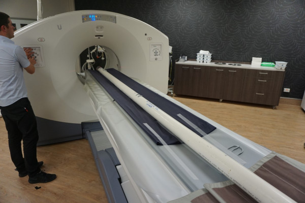
Sediment core being imaged by CT scanner (image by Nic Ross, provided).
Using an array of sophisticated techniques including CT scanning and geotechnical testing, the team will map and characterise volcanic-ash layers that underwent earthquake-driven liquefaction within lakes. Such liquefaction can then be linked to large earthquakes generated on faults in close proximity to the lakes. By better understanding earthquakes and liquefaction over the last 20,000 years, this research will provide unprecedented insight into future earthquake hazards, both in Aotearoa and around the world.
