Richard Patrick (Pat) Suggate
(1922–2016)
CNZM DSc FRSNZ
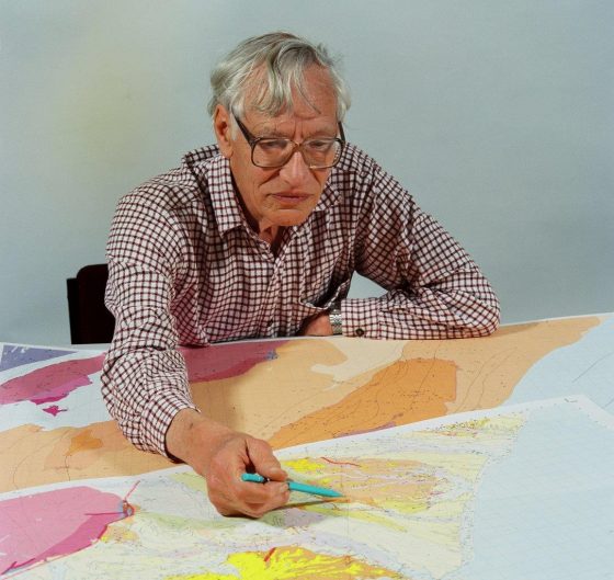
Pat Suggate working on the proofs of the Kumara-Moana map in 1999
R.P. (Pat) Suggate has had a distinguished career as a research scientist, Director of New Zealand Geological Survey, and a scientific mentor. His first scientific paper was published in 1950 and he continued active research into his retirement years, publishing his last paper in 2015.
Pat Suggate was born on St Patrick's Day in 1922. Too young for military service at the outbreak of World War 2, he completed a geology degree at Oxford University. He met his future wife, Daphne Reynolds, at university, and they were married in 1944. From 1942 Pat served with the Royal Artillery and the Royal Army Ordnance Corps, and was demobilised in early 1947 with the rank of captain. He started to look for work, and a fortunate meeting with New Zealand geologist Dave Brown, then studying in England, led him to apply for a job with the New Zealand Geological Survey.
Pat and Daphne arrived in Auckland on 15 April 1947, en route to Greymouth. In the late 1940s a succession of young geologists was sent to Greymouth to gain some experience under the stimulating influence of Harold Wellman. The Greymouth years had an enormous effect on Pat as they defined his long-term research interests, especially in coal rank, Quaternary stratigraphy and chronology and neotectonics. His first major investigation was to examine the coal resources of the Murchison area, with its exceptionally thick Cenozoic sequence and spectacular deformation. Over the next 40 years Pat returned to Murchison many times. and eventually completed mapping of the Cenozoic rocks for three 1:50 000 geological maps of the region.
Detailed mapping of the Reefton Coalfield led to studies of coal properties and their relationship to coal rank. His monograph New Zealand coals: their geological setting and its influence on their properties was a pioneering synthesis based on chemical data from a wide range of New Zealand coals.
After five years in Greymouth, the Suggate family moved to Christchurch. Some of the first radiocarbon results were coming available in the early 1950s, including wood and peat from beneath the city. Pat pulled together the information from a century of water drilling to produce a subsurface stratigraphy beneath Christchurch city, which was subsequently used as a key site for documenting the Postglacial rise in sea level.
Work on the glacial and interglacial rocks of Canterbury and the West Coast led to a long interest in Quaternary stratigraphy, and this was enhanced by a year spent at the Sub-department of Quaternary Research at Cambridge University in 1957-58. It also led to a long-term collaboration with Dr Neville Moar, palynologist at Botany Division, DSIR (now Landcare Research).
About that time the Suggate family returned from the UK, the Director of the New Zealand Geological Survey, Dick Willett, started the "Four Mile" project, an ambitious 10-year plan to prepare a set of I :250 000 geological maps covering the whole country. Although Pat is credited with the authorship of only one sheet (Christchurch), he played a major part in compilation of all sheets in the central South Island. especially the Quaternary stratigraphy. This culminated in the production of Late Pleistocene geology of the northern part of the South Island, New Zealand , which summarised the Quaternary sequences in different catchments, analysed the relationship between glacial deposits and raised interglacial shoreline deposits, and proposed an integrated chronology for the late Quaternary of New Zealand.
One aim of the '"Four Mile" project was to produce a definitive account of New Zealand geology. Pat was appointed editor, and supervised compilation and production of Geology of New Zealand and wrote substantial parts himself. Although much delayed before its eventual publication in 1978, this remains the most comprehensive account of New Zealand geology, still widely quoted. Pat was fortunate to survive the sinking of the Wahine in Wellington harbour in 1968, when the master copy of the manuscript was lost. The story of how he tucked a critical section into his jacket before abandoning ship has entered New Zealand’s geological folklore.
By the mid 1960s Pat was recognised as one of New Zealand’s leading geoscientists. He was awarded a DSc for his published work, and elected a Fellow of the Royal Society of New Zealand in 1963. From about 1965 onwards he played an increasing part in the management of the Geological Survey. He took over responsibility for the geological mapping programme and moved to Lower Hutt in 1967. As geologists started detailed mapping after the “Four Mile” project, he undertook the responsibility for raising the standards of geological map compilation and interpretation, and made a point of visiting and supervising younger geologists in the field.
Since his earliest days in Greymouth, Pat had been aware of the ongoing deformation of the New Zealand landscape. and helped develop methods of measuring and analysing deformation long before GPS surveys were available. He had a long friendship with Gerald Lensen, and they were both major contributors to a Royal Society report in 1973 that recommended implementation of an earth deformation studies programme in New Zealand. Pat continued as an active participant in many fundamental tectonic debates. including the role of the Alpine Fault and the application of plate tectonic theory to the continental geology of New Zealand.
Appointed Director of New Zealand Geological Survey in 1974, he initially had hopes of boosting basic geological mapping which he saw as the core purpose of a geological survey. He was only partly successful because the following decade was dominated by concerns about energy resources following the rising cost of oil after the Arab-Israeli war of 1973. The Government's response was to boost investigation and use of indigenous resources within New Zealand, culminating in the “Think Big” projects of the early 1980s. The Geological Survey expanded rapidly during this period with initiation of the Coal Resources Survey, the setting up of a Government-owned petroleum company. and enormous expansion in hydro-electric capacity including construction of the Clyde Dam. It was not an easy time to be in charge, with constantly changing priorities and political pressure for instant results. Pat's carefully considered advice did not always endear him to politicians or ministerial advisers, but he ensured that good quality scientific advice was consistently given (although not always heeded).
Taking a longer-term view, Pat appreciated that New Zealand needed a soundly-based understanding of its sedimentary basins, both onshore and offshore. to be able to intelligently explore for hydrocarbons. He started the Cretaceous-Cenozoic Project (CCP). a series of basin syntheses covering the whole New Zealand region. Although not completed until after he retired, in the 21st century we are seeing the value of this far-sighted approach as hydrocarbon exploration is able to take advantage of the comprehensive basin syntheses he initiated.
Throughout his period as Director, Pat insisted on high standards for all material emanating from the Geological Survey, reading and commenting on almost every document produced within the organisation. During this period he carried a huge workload, but any manuscript submitted for publication would be returned to the author within a few days, usually annotated with marginal comments in tiny handwriting, and often with a request to see a revised version.
Retirement in 1986 was an opportunity for Pat to actively continue his scientific research as a Research Associate. He completed several major mapping projects through to publication as well as a large number of papers on Quaternary stratigraphy and neotectonics and more recently on coal rank related to hydrocarbon generation. His studies of coal rank in many countries have allowed a general synthesis of the relations between coal analytical data of many kinds and the effects of burial and paleotemperature to be developed, and he developed a universal coal rank scheme (which became known as Suggate rank, Sr). He also took the opportunity to learn new skills – for example the advent of spreadsheets and electronic databases allowed him to analyse large collections of coal analyses from overseas coalfields. In his late eighties he taught himself analysis of seismic records so that he could critically evaluate seismic data from the West Coast.
One of Pat's characteristics has been his thoroughness and persistence. often revisiting problems he worked on earlier in his career. For example, his first published map of the sequence of multiple glacial advances in the Hokitika area was published in 1958. Several revised versions have been produced in the intervening 40 years, culminating in publication of a new map and description, which is one of the publications for which he was awarded the McKay Hammer by the Geological Society of New Zealand in 2001.
As well as his own research and administrative responsibilities, Pat Suggate has played a major part in the life of the scientific community, both nationally and internationally. He was a founder member and former president of the Geological Society of New Zealand. He had strong connections with the International Union of Quaternary Research (INQUA) and was a member of the Board of the International Geological Correlation Programme (IGCP) during 1987- 92. He was frequently used as a reviewer by journals and individuals, both because of his willingness to do this work and because his judgement was respected as sound while also being constructive. He has been a mentor to many younger scientists, and has taken a particular interest in helping them develop writing and presentation skills.
To mark Pat’s retirement a group of colleagues prepared a special Suggate issue of the New Zealand Journal of Geology & Geophysics (volume 44, no 1, March 2001) under the title, “Tectonics and climate change in New Zealand”. Because so many papers were submitted, some had to be held over until the following issue of the journal.
Pat’s last visit to GNS was in August 2015, for a function to mark the 150th anniversary of the founding of the Geological Survey. It was very fitting that he was able to cut the commemorative cake.
Selected bibliography
Pat Suggate has a publication list of approximately 120 papers in peer-reviewed journals, in addition to many abstracts and conference papers. The number is somewhat misleading as it overlooks the huge number of reports and official papers on geological topics that Pat completed, ranging from a manual for geological map compilation to a discussion of methods for estimating coal reserves. Some of the reports he worked on or compiled are credited to “Officers of the New Zealand Geological Survey”.
The following list has been compiled in consultation with a group of colleagues to indicate what we consider are Pat's most significant scientific publications. Although impressive, we would caution that it underestimates his contribution to applied geology and to the nuts-and-bolts of scientific work.
New Zealand geology and geological maps
Suggate RP 2015. Extensional basin development and subsequent inversion in Greymouth Coalfield. New Zealand Journal of Geology & Geophysics 58(1): 1-12.
Suggate RP 2013: Late Cretaceous and Paleogene stratigraphy and structure linking offshore with onshore north Westland. New Zealand Journal of Geology & Geophysics 56(4): 263-75.
Nathan S, Rattenbury MS, Suggate RP 2002. Geology of the Greymouth area, scale 1:250,000. Institute of Geological & Nuclear Sciences 1:250,000 geological map 12. 58 p. + 1 map.
Suggate RP, Waight TD 1999: Geology of the Kumara-Moana area. Institute of Geological & Nuclear Sciences Geological Map 24. 124 p. + 1 map.
Challis GA, Johnston MR, Lauder WR, Suggate RP 1994. Geology of the Lake Rotoroa area, Nelson. Institute of Geological & Nuclear Sciences Geological Map 8. 32 p. +1 map.
Roder GH, Suggate RP 1990. Sheet L29B - Upper Buller Gorge. Geological map of New Zealand 1:50 000. 52 p. + 1 map. Wellington, New Zealand. Department of Scientific and Industrial Research.
Suggate RP 1984. Sheet M29AC- Mangles Valley. Geological map of New Zealand 1:50 000. 40 p. + 1 map. Wellington, New Zealand. Department of Scientific and Industrial Research.
Suggate RP, Stevens GR, Te Punga MT (editors) 1978: The Geology of New Zealand. (2 volumes). Wellington, Government Printer. 820 p.
Adams RD, Eiby GA, Lowry MA, Lensen GJ, Suggate RP, Stephenson WR 1968. Preliminary reports on the Inangahua earthquake, New Zealand, May 1968. DSIR bulletin 193. Wellington, Government Printer.
Suggate RP 1965. The tempo of events in New Zealand geological history. New Zealand Journal of Geology and Geophysics 8 (6): 139-148.
Suggate RP 1963. The Alpine Fault. Transactions of the Royal Society of New Zealand (Geology) 2(8): 105-129.
Suggate. R. P. 1960. The interpretation of fault displacements of progressive flights of terraces. New Zealand Journal of Geology and Geophysics 3 (3): 364-374.
Oborn LE, Suggate RP 1959. Sheet 21 - Christchurch. Geological map of New Zealand 1:250 000. Wellington, New Zealand. Department of Scientific and Industrial Research. [2nd edition by R. P. Suggate, 1973]
Suggate RP 1957. The geology of Reefton subdivision (Reefton sheet S38). New Zealand Geological Survey Bulletin 56. 146 p + 8 maps.
Suggate RP, Couper RA 1952. The stratigraphic relations and plant microfossils of New Zealand coal measures. New Zealand Journal of Science and Technology B34 (2): 106-117.
Suggate RP 1950. Quartzose coal measures of west Nelson and north Westland, New Zealand. New Zealand Journal of Science and Technology B31 (4): 1- 14.
Coal rank studies
Suggate RP, Boyd RJ 2012. Greymouth Coalfield, New Zealand: vertical coal rank gradients, depths of burial and paleotemperatures. New Zealand Journal of Geology & Geophysics 55(2): 111-26.
Suggate RP, Dickinson WW 2004. Carbon NMR of coals: the effect of coal type and rank. International Journal of Coal Geology 57(1): 1-22.
Suggate RP 2002. Application of Rank (Sr), a maturity index based on chemical analyses of coals. Marine & Petroleum Geology 19(8): 929-50.
Suggate RP 2000. The Rank (Sr) scale: its basis and applicability as a maturity index for all coals. New Zealand Journal of Geology and Geophysics 43 (4): 521- 553.
Suggate RP 1998. Relations between depth of burial, vitrinite reflectance and geothermal gradient. Journal of Petroleum Geology 21 (1): 5-32.
Suggate RP 1998. Analytical variation in Australian coals related to coal type and rank. International Journal of Coal Geology 37 (314): 179- 206.
Killops SD, Funnell RH, Suggate RP, Sykes R, Peters KE, Walters C, Woolhouse AD, Weston, R. J. ; Boudou J-P 1998: Predicting generation and expulsion of paraffinic oil from vitrinite-rich coals. Organic Geochemistry 29 (113): 1- 21 .
Suggate RP, Boudou JP 1993 : Coal rank and type variation in Rock-Eval assessment of New Zealand coals. Journal of Petroleum Geology 16 (1): 73-88.
Suggate RP 1990. Variability in type 111 organic matter at the initiation of diagenesis. In: Nuccio VF, Barker CE, Dyson SJ, editors. Applications of thermal maturity studies to energy exploration. Society of Economic Paleontologists and Mineralogists. Pp. 45- 52.
Suggate, R. P. 1990: Coal ranks in Permian- Lower Cretaceous rocks of New Zealand. New Zealand Journal of Geology and Geophysics 33 (2): 163- 172.
Suggate, R. P.; Isaac, M. J. 1990: Depths of burial of eastern Southland lignites, estimated from their moisture contents. New Zealand Journal of Geology and Geophysics 33 (2): 173- 180.
Suggate RP 1982. The influence of moisture content on vitrinite reflectance and the assessment of maturation of coal. New Zealand Journal of Geology and Geophysics 25 (2): 227-231.
Suggate RP 1982: Low rank sequences and scales of organic metamorphism. Journal of Pe1roleum Geology 4 (4): 377- 392.
Suggate RP 1974: Coal ranks in relation to depth and temperature in Australian and New Zealand oil and gas wells. New Zealand Journal of Geology and Geophysics 17(1): 149- 167.
Suggate RP 1972: Coal rank from pyrochromatography. New Zealand Journal of Science 15(4 ): 601- 6 14.
Suggate RP 1967: Metamorphic rank in Taiwan coals. Bulletin of the Geological Survey of Taiwan 19: 15- 24.
Elphick JO, Suggate RP 1964: Depth/rank relations of high volatile bituminous coals. New Zealand Journal of Geology and Geophysics 7(2): 594-601.
Rogers J, Suggate RP, Elphick JO, Ross JB. 1962. Metamorphism of a lignite. Nature 195(4846 ): 1078-1080.
Suggate RP 1959: New Zealand coals: their geological setting and its influence on their properties. DSIR Bulletin 134. 113 p.
Suggate RP 1956 Air drying of coal. New Zealand Journal of Science and Technology 838: 139- l48.
Suggate RP 1956. Depth-volatile relations in coalfields. Geological Magazine 93: 201- 207.
Quaternary stratigraphy and neotectonics
Moar N, Suggate RP, Burrows C 2008. Environments during the Kaihinu Interglacial and Otira Glaciation, coastal north Westland, New Zealand. New Zealand Journal of Botany 46(1): 49-63.
Suggate RP, Almond PC 2005. The Last Glacial Maximum (LGM) in western South Island, New Zealand: implications for the global LGM and MIS 2. Quaternary Science Reviews 24 (16/17): 1923-40.
Suggate RP, Moar N, Hormes A, Preusser F, Schluechter C 2004. Dating the main north Westland glacial advance of the late Otira Glaciation: the Raupo section. New Zealand Journal of Geology & Geophysics 47(1): 155-56.
Moar NT, Suggate RP 1996. Vegetation history from the Kaihinu (last) interglacial to the present, West Coast, South Island, New Zealand. Quaternary Science Reviews Science 15: 521-547.
Suggate RP 1992. Differential uplift of Middle and Late Quaternary shorelines, northwest South Island, New Zealand. Quaternary International 15/16: 47-59.
Suggate RP, Watters WA 1991.”Inside-out weathering of boulders in glacial outwash gravel. New Zealand Journal of Geology· and Geophysics 34 (1): 93- 97.
Suggate RP 1990. Late Pliocene and Quaternary glaciations of New Zealand. Quaternary Science Reviews 9: 175-197.
Suggatc, RP 1989. The postglacial shorelines and tectonic development of the Barrytown coastal lowland, north Westland, New Zealand. New Zealand Journal of Geology and Geophysics 32(4): 443-450.
Suggate, RP 1987. Active folding in north Westland, New Zealand. New Zealand Journal of Geology and Geophysics 30(2 ): 169- 174.
Suggate RP 1988. Quaternary deposition and deformation in the Buller and tributary valleys. New Zealand Geological Survey Record 25. 51 p.
Suggate RP 1985. The glacial/interglacial sequence of north Westland, New Zealand. New Zealand Geological Survey Record 7. 22 p.
Suggate RP, Moar NT 1979. Contributions to the Quaternary history of the New Zealand flora 8: interglacial and glacial vegetation in the Wcstport district, South Island. New Zealand Journal of Botany 17(3): 361-387.
Suggate RP, Cresswell MM (editors) 1975. Quaternary studies: selected papers from IX INQUA Congress, Christchurch, New Zealand, 2-10 December, 1973. Royal Society of New Zealand Bulletin 13. 320 p.
Suggate RP, Moar NT 1970. Revision of the chronology of the Late Otira Glacial. New Zealand Journal of Geology and Geophysics 13(3): 742- 746.
Suggate RP 1968. Post-glacial sea-level rise in the Christchurch metropolitan area, New Zealand. Geologie en Mijnbouw 47(4): 291- 297.
Suggate RP 1965. Late Pleistocene geology of the northern part of the South Island, New Zealand. New Zealand Geological Survey Bulletin 77. 91 p.
Suggate RP 1963: The fan surfaces of the central Canterbury Plains. New Zealand Journal of Geologv and Geophysics 6(2): 281- 287.
Suggate RP, West RG 1959: On the extent of the last Glaciation in eastern England. Proceedings of the Royal Society [London] B150: 263- 283.
Suggate RP, Gage M 1958. Glacial chronology of the New Zealand Pleistocene. Bulletin of thee Geological Society of America 69: 589- 598.
Suggate RP 1958. Late Quaternary deposits of the Christchurch metropolitan area. New· Zealand Journal of Geology and Geophysics 1: 103- 122.
Suggate RP 1950: Franz Josef and other glaciers of the Southern Alps. New Zealand. Journal of Glaciology 1(8): 422-429.
Memoir
Suggate RP 2016. Geological memories. GSNZ Journal of the Historical Studies Group 54: 2-20.
Dr Simon Nathan
Emeritus Scientist, GNS Science
Lodged on website Thursday, 22 December 2016.